Beeripmo walk outlined in "Bushwalking in Australia"
Length: 16.6km
Duration: 2 days
Region: Western Victoria, between Ballarat and the Grampians
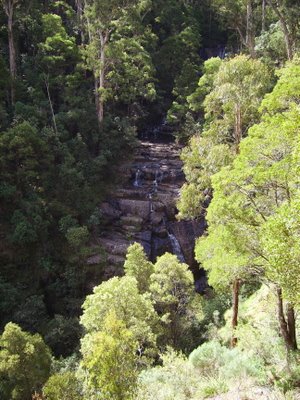
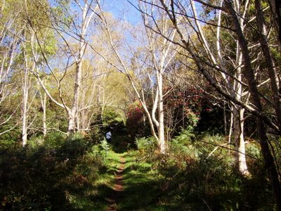
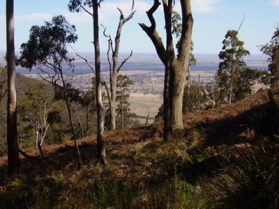
This is a very good walk. We had good weather both days (~25-27 degrees). The first day scaled upwards and the second day was a lot easier as you are going downwards most of the way. The views from around Cave Hill were fantastic. Its worth doing the walk just for the lookouts around the Cave Hill area. This walk could be done as a long day walk but I appreciated having the break overnight as I was quite tired after heading in an upward direction for the first half of the walk.
The Beeripmo Campsite is well maintained and very comfortable with drop toilets and low tables to prepare food on. It was good to see that there was no rubbish left behind by fellow campers. We were the only ones there that night. The water from the tanks at Beeripmo camp looked a little dodgy. However, we boiled some up and added chlorine and we live to tell the tale :).
The walk is very easy to navigate with plenty of signposting. Most of the walk utilises walking tracks rather than firetrails, which was good. The walk goes through areas of dry Australian brushland, ferny gullies and areas of tall gums. A walk that demonstrates the Australian landscape and has some good views from the lookout areas.
3.5 out of 5 stars
Tuesday, October 24, 2006
Saturday, October 21, 2006
Sherbrooke Forest
Walk 23 from "Day Walks Melbourne"
Length: 11.5km
Time: 4 hours
Region: Dandenong Ranges, Victoria
Setting off:
I did this walk with some friends and family. This is the second time that I've completed this walk. The walk is pleasant and utilises walking tracks and firetrails. I would recommend this walk for anyone wanting to do a lazy Saturday afternoon tramp. Its easy to navigate and it has enough hills and environmental variation to keep you interested.
3 out of 5 stars
Wednesday, September 27, 2006
Mason Falls Circuit
Walk 26 from "Day Walks Melbourne"
Length: 13.5km
Time: 4.5 hours
Region: Kinglake National Park, Victoria
At the picnic area -
This was a good walk. It was a warm and sunny day. I went there with my brother-in-law. Its a very easy walk to do from a navigational point of view. The last uphill section (firetrail) before arriving at the picnic area is ordinary but the falls are worth seeing. At the picnic ground, we got the chance to get really close to lyrebirds and an assortment of other native birds (Very cool). I probably wouldn't do it again but its fine for a once off.
The falls from the lookout -
3 out of 5 stars
Tuesday, September 12, 2006
Olinda Valley
Walk 24 from "Day Walks Melbourne"
Length: 12.1km
Time: 3.5 hours
Dam Road (This is the same place as the picture on p.122) -
We decided that we would do another short walk. It was a beautiful sunny day (~20degrees) with little cloud overhead. We followed the outlined map in the book with one deviation. The deviation that we took was at the end of Rifle Range Gully Track. Instead of going up Barges Track, we went on Bartlett Track which was more of a walking track than Barges Track (we've been on Barges Track before). It was a good deviation and I highly suggest it. Bartletts Track then reenters Barges Track and you continue walking onto Georges Track. We then sat down and had lunch at Eagles Nest Picnic Ground which is a lovely grassy opening in the middle of the bushland. The circuit ends with a stroll through the arboretum which is pictured below and it is a very steep walk back up to the beginning. Overall, it was a good mix of walking tracks and firetrails and had nice scenery.
The walk back through the arboretum -
3.5 out of 5 stars
Tuesday, September 05, 2006
Olinda Falls
Walk 25 from "Day Walks Melbourne"
Length: 7.2km
Time: 2.5 hours
At the Falls-
Today we went to Olinda Falls, for a short walk on our day off. We followed Mechanics Track at the start; it is an overgrown path through rainforest, which follows the Olinda Creek. We took a short detour to the Olinda Falls, which were very pretty. Nearing the end of Bartlett track as you walk toward Falls road, there is a small little road/track on the left. This little track opens up to a nice little clearing worth having a peek at. Overall this walk was easy and the day was a little overcast but with the sun breaking through. This is not the best walk that we've done but it was a good walk to do when you only want to do a short walk. We stopped to look at things along the way and went off the tracks to see things that interested us, so it took a little longer than the suggested 2.5 hrs.
Along Mechanics Track -
3 out of 5 stars
Subscribe to:
Posts (Atom)